
Strengthening Europe’s eastern borders with electromagnetic awareness
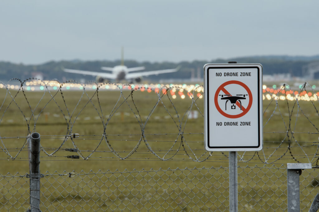
Drone incursions present a significant security challenge along Europe’s eastern borders, with implications for national borders, airspace, nearby communities, and critical infrastructure.
Sponsored feature by:

A distributed electromagnetic sensing network could strengthen early warning and threat assessment, allowing local sites to serve their own operational needs while joining together to contribute to a shared national picture.
One Baltic morning
At 07.00, border guards in a Baltic nation spot an unidentified drone crossing into national airspace. Ten minutes later, coastal surveillance detects several vessels approaching territorial waters with no Automatic Identification System (AIS) transmitting. At 07.20, residents report drones flying near an international airport.

Three incidents within twenty minutes. Are they connected?
In this hypothetical scenario, each report sets a different response in motion. Border guards alert military authorities. Maritime agencies investigate the suspect vessels. Airport authorities immediately close airspace to assess whether flight operations can continue safely. Each organisation holds information that could be vital for national security, yet there is no complete local or national intelligence picture.
Disruption will begin long before hostile intent is established. Inevitably, flights will be delayed, maritime traffic diverted, and security resources committed while authorities determine the scale of the threat.
When addressing this situation, there are two main challenges: The first is to manage the incident locally. The second is for the national authorities to understand the wider picture and rapidly establish whether these separate observations are unrelated or indicate a wider pattern. Electromagnetic awareness could provide some of the intelligence required to address both challenges.
While this scenario is hypothetical, the threat drones pose to European security is very real.
Multiple incidents, one security problem
Recent incidents across Europe have shown how quickly a drone detection can become a national security emergency.
In the early morning of 15 September 2026, Italian Eurofighters operating under NATO intercepted a drone that had entered Lithuanian airspace. On recovering the wreckage, authorities neutralised its explosive payload. The incident highlights the importance of persistently monitoring national airspace so authorities can assess threats while there is still time for intervention.
Further south, drone incursions have provoked military responses and endangered lives. Violations of Polish airspace on 10 September 2025 prompted measures to strengthen surveillance and defence along the eastern flank. In Romania, a drone struck a residential building in Galați on 29 May 2026. The drone was detected before it entered Romanian air space; however, continuous tracking, assessment, and having increased decision time also contribute to successful defences.
Vulnerability also extends west. In August 2026, flight operations at Leipzig/Halle Airport were suspended after an employee discovered a drone carrying an explosive device. Threats to national security can emerge well beyond Europe’s eastern borders.
Disruption is cheap, while security is expensive
Relatively inexpensive drones can impose costs far beyond their unit price. An incursion will likely delay flights, disrupt freight, divert police resources, and drive a military response. Even without physical damage, disruption can undermine public confidence in government and the authorities.
Disrupting one specific site can have consequences beyond the immediate incident. Concentrating personnel and assets in one area may reduce security elsewhere, creating further vulnerabilities. Repeated incidents compound the problem. Authorities must remain perpetually alert, businesses must absorb shocks, and governments must divert resources to combat threats with unclear intentions.
The strategic challenge is maintaining effective protection as incidents become more frequent while the next target remains unclear. This requires local authorities to monitor their own sites while national authorities can connect the national picture.
Given recent incidents, the case could be made for additional sensing capabilities that improve electromagnetic situational awareness. Drones that transmit control, telemetry, or video signals can reveal their presence through these emissions. Detecting and locating signals can give border units, infrastructure operators, and security agencies critical data for early warning and analysis.
What is electromagnetic awareness?
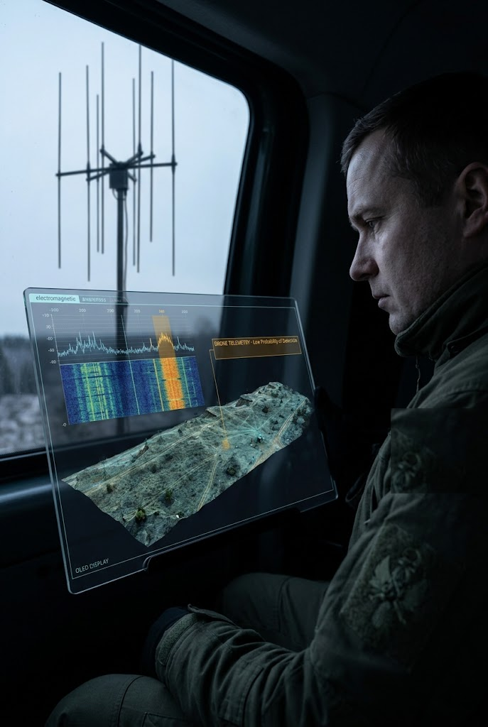
Electromagnetic awareness is understanding how the radio frequency (RF) spectrum is being used by all wireless technologies. It provides intelligence on what is transmitting, where the signal is coming from, and how the signal changes over time. To gain electromagnetic awareness, a network of passive RF sensors must be deployed around a target location, and a normal pattern of activity established, potentially including emitters from cellular networks, broadcast networks, and emergency services communications.
Passive RF sensors ‘listen’ for all RF transmissions, including drone control links and video feeds, without emitting signals themselves. This allows them to ‘see without being seen’. Software allows operators to characterise emissions and geolocate them over time.
Data from RF sensing contributes to the Recognised Electromagnetic Picture: an assessed view of signal activities across a specific geographic area that provides information about a signal’s location, behaviour, and changes over time. An unfamiliar signal may warrant closer investigation, but a low probability of detection signal transmitted on a frequency consistent with known drone telemetry links may require immediate further assessment.
Electromagnetic information can complement any existing air surveillance, which often struggles to detect drones because of their size, shape, construction materials, and low flight paths. Any available video imagery, acoustic sensing, or drone tracking software can be used to provide additional intelligence.
Passive RF sensing can provide intelligence in areas where there is no radar coverage, due to gaps or the high installation cost of installing radar. It can also be used to cue radar in situations when radar cannot operate persistently. The relatively low cost of establishing a network makes it easier to detect threats in the spectrum before they are visually confirmed.
From local surveillance to a shared national picture
Although the ultimate goal is to obtain a shared national electromagnetic picture, the project begins with the operational needs of individual sites: airports, ports, energy facilities, and border units. Each unit operates its own sensing network, understanding normal RF activity so any deviations can be investigated quickly.
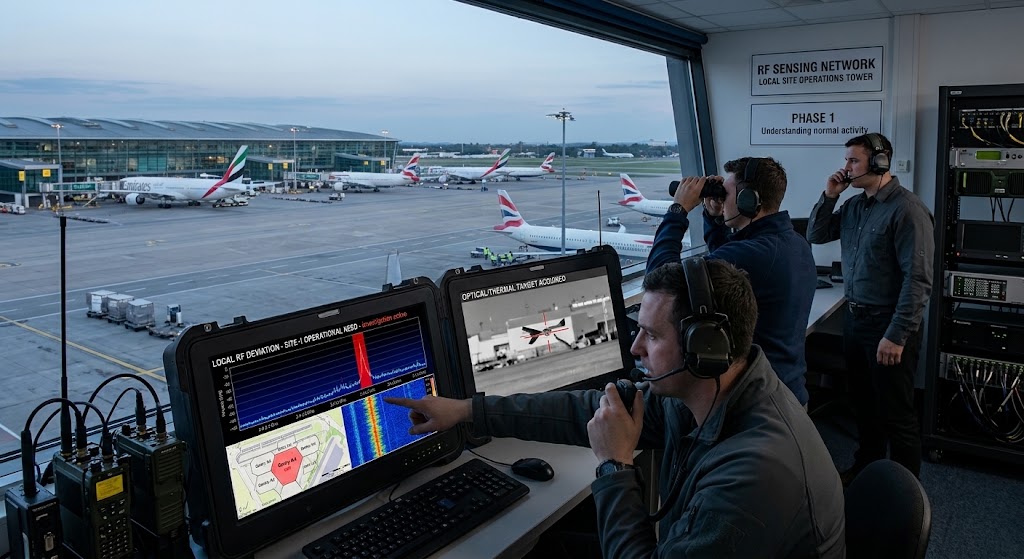

Organisations operating individual networks retain total control of their systems, while also being able to connect to other networks through federation. They can share selected information through common standards and access rules. This means that one site can contribute relevant observations without making all its data available to every other user.
Regionally, organisations could correlate observations and exchange alerts. Think back to the airport and border unit described in the hypothetical scenario. Joint examination of timing, locations, and signal characteristics could reveal key information about the threats or an adversary’s behaviour.
National agencies could correlate RF data with air-surveillance intelligence to assess wider patterns. International networks involving neighbouring countries could extended early warning and intelligence gathering across borders.
The value of joining separate networks is that the whole is greater than the sum of its parts. While an individual site would benefit locally, it would also benefit from joining a network spanning the whole eastern border of Europe.
While spectrum sensing cannot prevent drones being launched, its value lies in earlier warning and shared intelligence, meaning less disruption and more effective use of resources. As part of a layered security system using other sensors, electromagnetic monitoring can give authorities more time to assess activity and select a proportionate, cost-effective response.
Conclusion: contributing to Europe’s wider security effort
This proposed approach is consistent with the European Commission’s 2026 Action Plan on Drone and Counter Drone Security, which addresses shared situational awareness, critical infrastructure, and external borders. The plan proposes integrating relevant information into a shared air display and supporting counter-drone capabilities for infrastructure and border protection. These priorities provide a policy context for considering how locally operated electromagnetic sensing networks could contribute to wider surveillance systems.
The debate over a European “drone wall” raises a related challenge. In his October 2025 Chatham House analysis, Tim Chattell argues for cooperation across borders, and clear frameworks for safe and rapid intervention. Protecting Europe’s eastern borders also depends on whether institutions can share information, exercise clear responsibilities, and maintain public confidence when incidents occur. Electromagnetic sensing can play a role in achieving these goals.


